
3rd Grade Pirate Maps
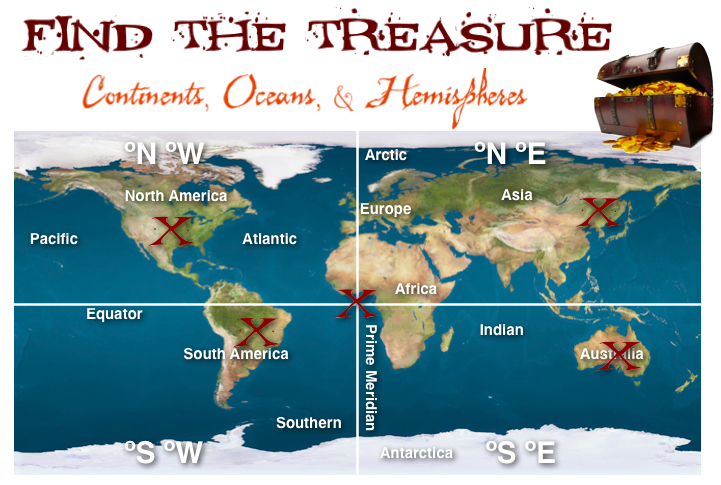 Third grade students in Ms. Ford’s class at Laburnum Elementary have been learning about the continents, oceans, and hemispheres (SOL3.5). So today we practiced finding and burying pirate treasures on various continents and oceans based on their hemispheres (really, using latitude and longitude lines). I gave them a template with a map and some questions that you can download by clicking here. First they had to label the continents and oceans on the map. Next we labeled the hemispheres by breaking them up into 4 quadrants: northeast, southeast, northwest, southwest. Now, using latitude and longitude coordinates we could figure out which quadrant we were in. I gave the students three treasures to find first. They entered the coordinates on iTouchMap and found where the treasures were located. Then they put a big red X on the spot. The next task was a little harder. I gave them coordinates that put the treasure in the ocean, but they had to adjust them to move the treasure to land. After testing a few numbers, the students figured out that the numbers get larger the farther away they are from the Equator or Prime Meridian and were finally able to place the treasure on land. For the last task, students could place the treasure anywhere they wanted, but they had to find the coordinates for the site and write it out as a question for a friend to solve. This activity adds a bit of math and problem solving to the continents, oceans, and hemispheres topic. Let me know if you’d like to try it out with your class!