
4th Grade Virginia Geography Maps
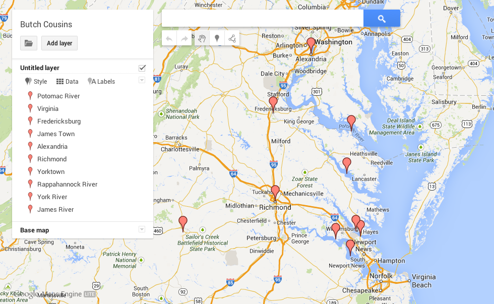 Fourth grade students in Ms. Cousins’ class at Davis Elementary created their own Virginia geography maps to show the different places and features they need to know (VS.2). They used Google Maps Engine Lite to place markers on and around Virginia identifying the five regions, the five bordering states, and the 4 major rivers. They also labeled the important cities for each river. Take a look at a student example here. They caught on quickly and enjoyed color coding their different place markers. Since it’s a Google Map it’s fully scrollable and zoomable so some students, like this one, even went further and identified their school and their country of origin. Students can go home and show their parents and study the information in a way that’s personally meaningful. I’m hoping this will be a tool, like Google Earth, that teachers use all year long in their geography lessons. Let me know if you’d like me to show your class how to do it.