
4th Grade Multiplication Maps
 Fourth graders at Holladay Elementary have been learning about life in colonial Virginia and the Revolutionary War (VS.4,VS.5), and they’ve been learning how to multiply two digit numbers in math (SOL4.4), so today we made multiplication maps about colonial Virginia in Ms. Ficor’s class. First we discussed which major cities existed during this time (Norfolk, Richmond, Williamsburg, Yorktown). We also talked about what activities would require colonial people to travel from town to town (trading, spying, fighting, visiting). I explained that they would be creating maps with a story problem to solve. They would have to figure out the distance between two towns, tell why a colonist was traveling back and forth between those towns, and tell how many times that person made the trip. Then their classmates would solve each others’ problems. I posted a link to My Google Maps on their Google classroom page. The students placed markers on the two towns their colonists were traveling between and then clicked for directions. A blue line is automatically created with the distance. I showed how they could change the mode of transportation to walking. Next they shared their maps and copied the link to post to the classroom page. They wrote their story problem in their post, and their classmates solved them in the comments. I pointed out that they needed to solve their own problems, so they could check the answers. You can try out some of their problems here.
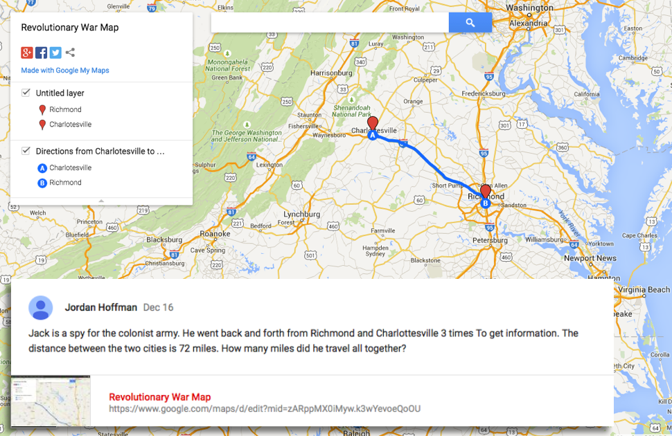